We’ve been taking trips around the western USA in our 20ft travel trailer Howie for over two years. I find myself relying on the same websites, apps and navigation tools to help get to where we are going.
Here are a few of my favs as of Feb 2023:
Trip Planning
- recreation.gov app & recreation.gov – the must-visit website/app for planning a trip to a National Park. Camping, lodging, tickets, passes, permits, and even day-use passes can be bought or reserved here. We have a lifetime America the Beautiful pass ($80) and we’ve enjoyed getting into national parks for free.
- Roadpass.com & app: although TogoRV,com-related websites & apps have free & trial versions. A Roadpass Pro subscription is one of the few I have. It gives me access to all the features of TogoRV-related websites & apps such as:
- Roadtrippers – which has become my favorite desktop and mobile trip-planning tools
- Campendium – is a great campground search tool & the pro features are included with a Roadpass Pro subscription. During a regional search, it’s map displays all the campsites, rv dump sites, state & county campgrounds, and dispersed (free) campgrounds. It can check for site availability & often take you to a booking portal. I use this and GoodSam to find campgrounds since we prefer hookups vs dry-camping/boondocking.
- TogoRV.com & app – general RV information, maintenance reminders, discounts on products and campsites. If you follow RVMiles on YouTube, you can stay current on RV news, RV app news, and often get a discount code for the annual subscription ($10 off).
TogoRV GPS app provides navigation that considers weight limits, overhead clearances, grades of terrain, and your route preferences to give you turn-by-turn directions specific to your RV.
- GoodSam app & GoodSam.com – When we started RVing, I bought a multi-year membership from Camping World. It’s 10% discount on campsites has more than paid for itself over the past two years. I will very likely renew it this August, when it expires. GoodSam has a reliable campground review and rating system along with booking site portals.
- FlattestRoute – is a free website that let’s you enter your start and end point and calculates the flattest route. It’ also works’s also great for bicycle route planning. It calculates & scores the different routes using a point system based on incline %grade, duration, & distance. I still prefer InRoute but this can show you some alternate options.
- KOA app & .com: we’ve enjoyed staying at KOA campgrounds during our trips. They usually have available sites when others don’t, nice amenities, plus with a membership, are affordable. The only ‘quirky’ thing about KOAs is often their name vs location. They are named for nearby destination spots but are often many miles away. Monterey/Santa Cruz KOA is ~32mi away from Monterey; St.George KOA is 15mi from St. George; Joshua Tree KOA is 37mi away from Joshua Tree’s west entrance, 53mi away from the north entrance.
Still, if you compare the KOA location vs your desired destination(s). You can decide if it’s worth the drive – campsite availability often decides for you.
Navigation (and Route-planning)
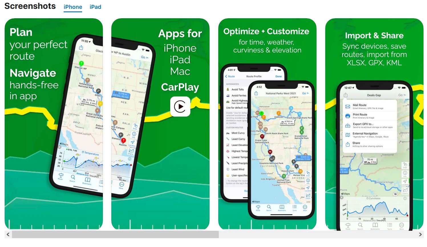
- InRoute – free iPhone app that helps route planning AND navigation. The free version allows 8 locations and the subscription version allow 150 locations (destination, attractions on-route, waypoints, gas stations, etc). I find the 8 points adequate since I only use it for identifying the route that has the lowest elevations/inclines and least curvy. If you have more than 8 waypoints, you can break your trip into groups of 8.
Like other RV navigation apps, it plans the optimal RV-friendly routes with height clearances (based on your RV height setting), no tolls, & no propane restrictions. I have yet to find another mobile app that graphically shows the elevation & curviness plus distances & drive times of three alternate routes. It has audible turn-by-turn directions but if Apple Maps shows the same course, I usually use it, synced with my Apple Watch. - Google Maps – of course, this is a great route planning & navigation app but often chooses shortest vs the best RV-friendly routes. I made the mistake of doubting InRoute and used Google Maps to navigate to Ventura Ranch KOA. It took me on the shortest but curviest white-knuckle route possible. So I only use it when unhooked or its route matches InRoute’s.
- Apple Maps – same situation as Google Maps, I do not use it for RV route-planning. I will use it when towing if the directions match InRoute’s. It’s great for general directions and it syncs with my Apple Watch. Giving me haptic turn reminders so I can keep my eyes on the road.
Hiking
- AllTrails app & AllTrails.com or GaiaGPS – I have both AllTrails and GaiaGPS but primarily use AllTrails since it just works for me. I prefer its interface, downloadable offline maps & hike-tracking features, enough to subscribe to AllTrails+. If you hike, bike, or off-road in areas without cell service, these apps are essential.
Downloading Google Maps for use offline is an affordable alternative. But it you like saving your trek, then using either of these apps is great for recording your actual path. - Garmin app & .com – we still use a Garmin Inreach Mini 2 GPS for its SOS feature. We know that our new iPhones have SOS but the tried-and-true Garmin’s battery lasts a lot longer & is a reliable two-way satellite communicator. So, for us, for now, it’s still clipped to our gear when we hike anywhere.

